
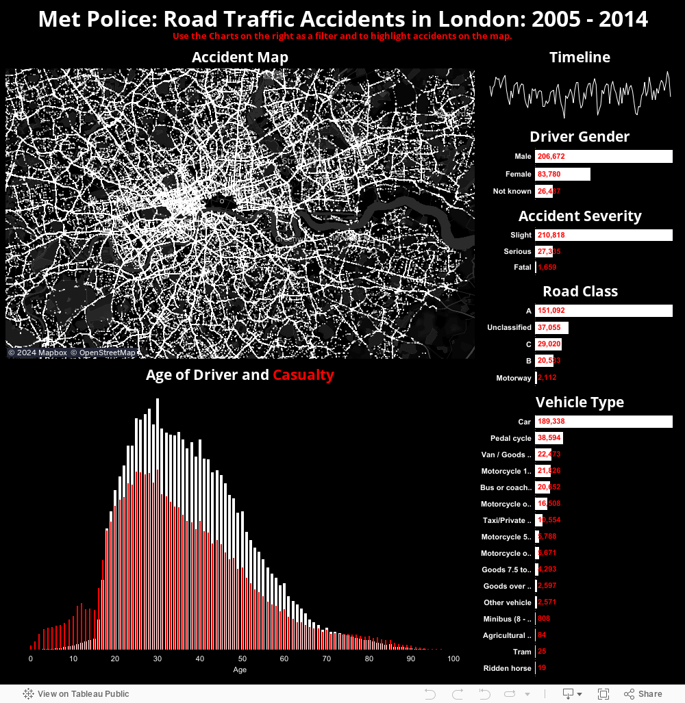
For that reason you really need to filter it down to stop everything grinding to a halt (though this sounds like a future challenge potentially). So, I took the most instantly recognisable city in Europe, maybe the world, and plotted all RTAs within the Metropolitan Police jurisdiction. Note City of London is empty. I assure you, cars can crash there, it's just they have their own separate police force.
Anyway, to the viz!
No comments:
Post a Comment